
For additional Information, Contact
Charles
Jamgotchian, Owner &
Broker, DRE Lic# 670397
2706 W. Ashlan #65, Fresno, CA 93705
Phone: 559-226-5796
e-mail: chuckj@rexinet.c
600 Acre Sierra Ranch
Also available is the adjoining
80 Acres and 160 Acres
Between Raymond and Ahwahnee, California
SOLD
Description: ID# 6680
Beautiful ranch with some very gentle areas and some steep rugged
areas.
Old homestead, however no power or phone. In the williamson act
for
low taxes and mostly fenced. Has 1/4 mile frontage on the
Chowchilla
River. Elevations range from 1100 to 2300 feet. Large
gentle areas on the western and eastern portion, balance is
steep.
Springs and seasonal creek.
Location:
Area known as Bailey Flats, access is via Roads 800 and 810, then
through
the red gate along a private road known as Bessie Jacobs Rd. Red
gate is kept locked. Green gate at entrance to the ranch is open.
Improvements:
2 old structures are not usable. In the old days, water for these
homes was from a spring located in the seasonal creek. Rocks with
grinding holes exist near the River.
Present and Best Use:
Ranch is in 2 legal parcels
APN 053-033-005 is ± 80 acres.
APN 053-035-002 is ± 520 acres
Other items to consider
Ranch is not totally surveyed. Fences are not necessarily on
the property lines.
There is no power to the ranch. The property to the north has
a home and power.
The road that goes through the ranch also is used by other property
owners.
Property is in the Williamson Act.
Ranch has considerable GAME. Deer, Turkey, Wild Pigs, Quail,
etc.
Elevations range from 1100 to 2300 feet.
Disclosures
If you wish to build a home, contact the various governmental agencies
to determine the feasibility and requirements. You should also
contact
the local fire chief or California Division of Forestry regarding SRA
Fire
Safe Regulations, PRC 4290 - Title 14
The west line of the 80 acres has just been surveyed. The SW
corner is on the west side of the river, the NW corner is on the east
side.
Bessie Jacobs Rd. is not deeded.
Williamson
Act Info and new Legislation including info on AB 1492
Example
of the 4290 Fire Safe Regulations
Aerial
View of Ranch
SOLD
FIRM PRICE: 600
Acres
$900,000
80 Acres $200,000
160 Acres $304,000
Cash Preferred
See the following Maps, Pictures and Topography maps
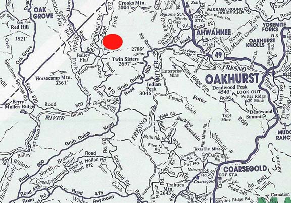
Location Map

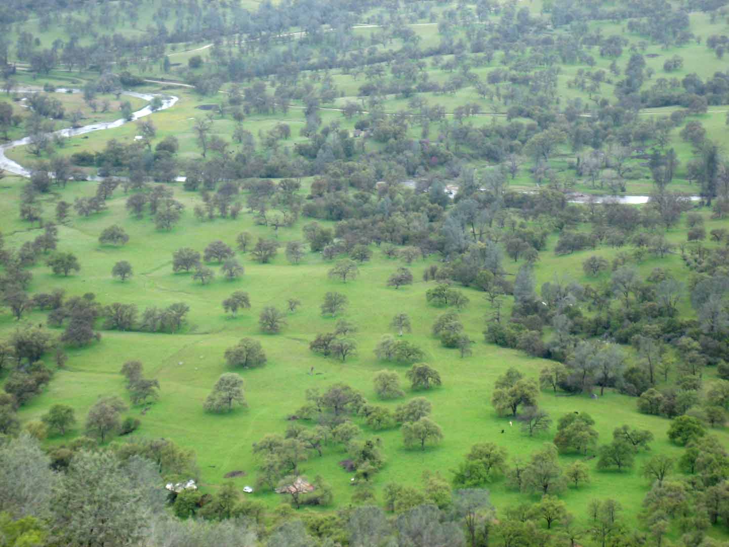
River Bottom and Lower Meadows
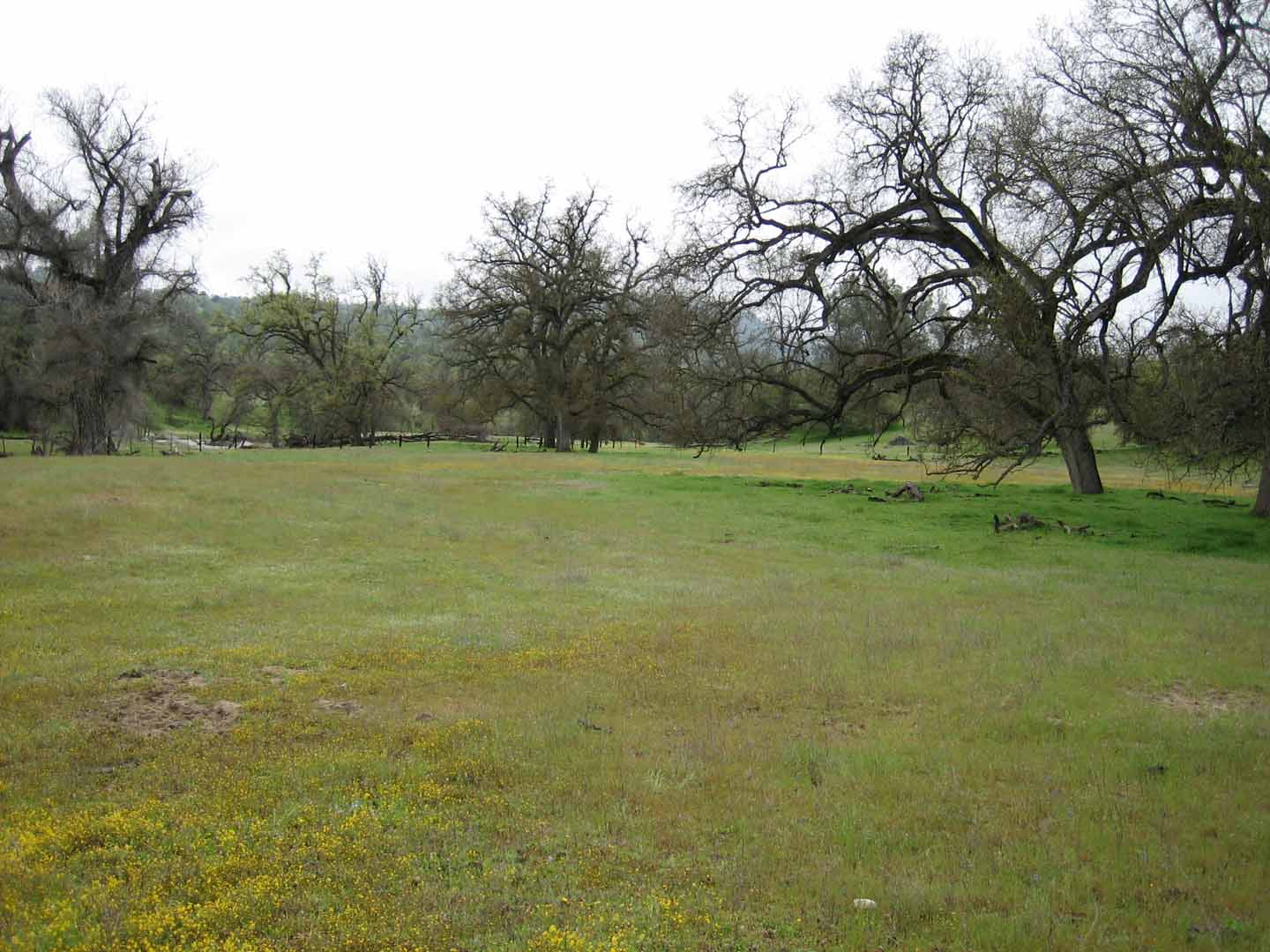
Lower Meadows
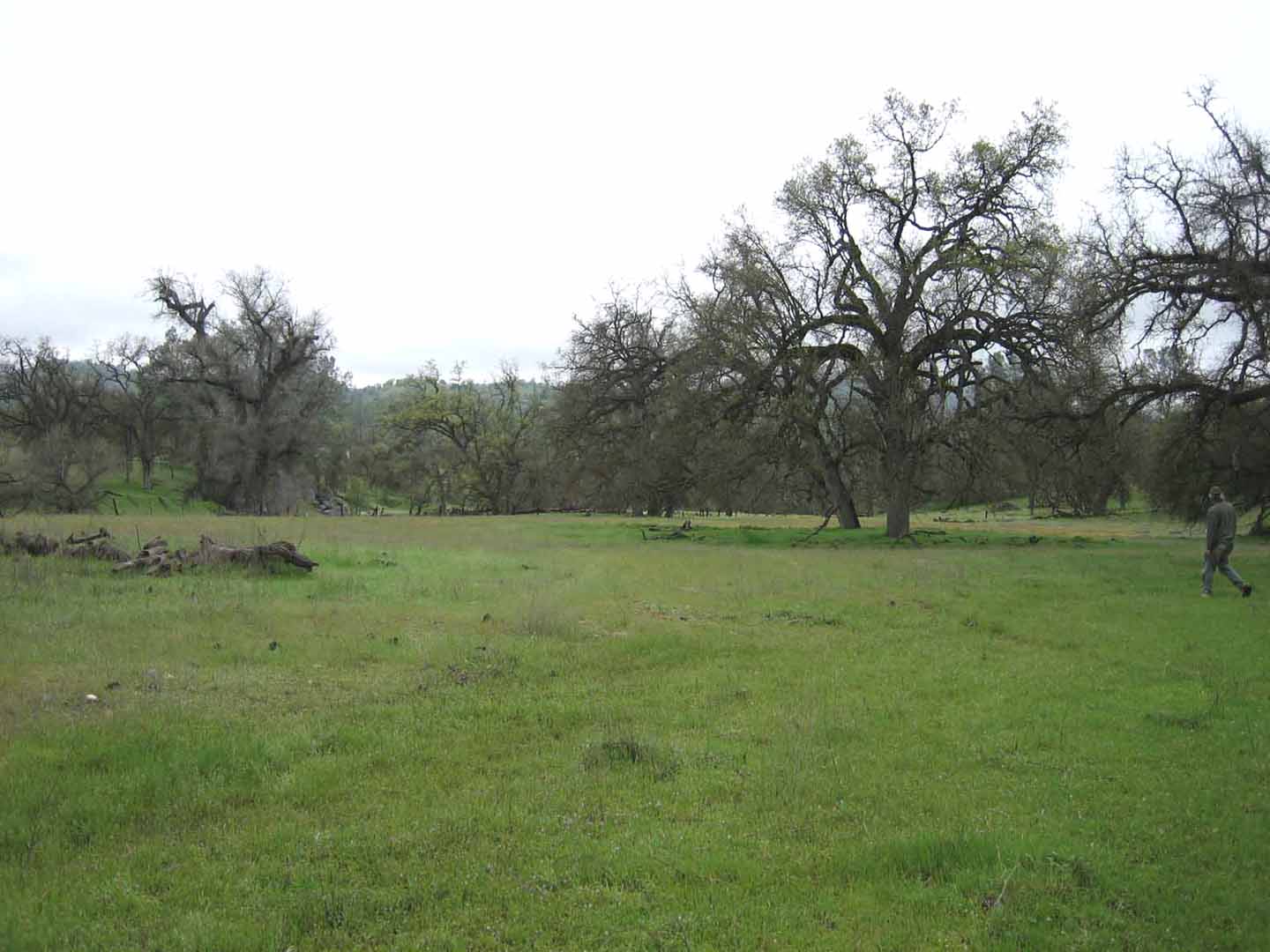
Lower Meadows
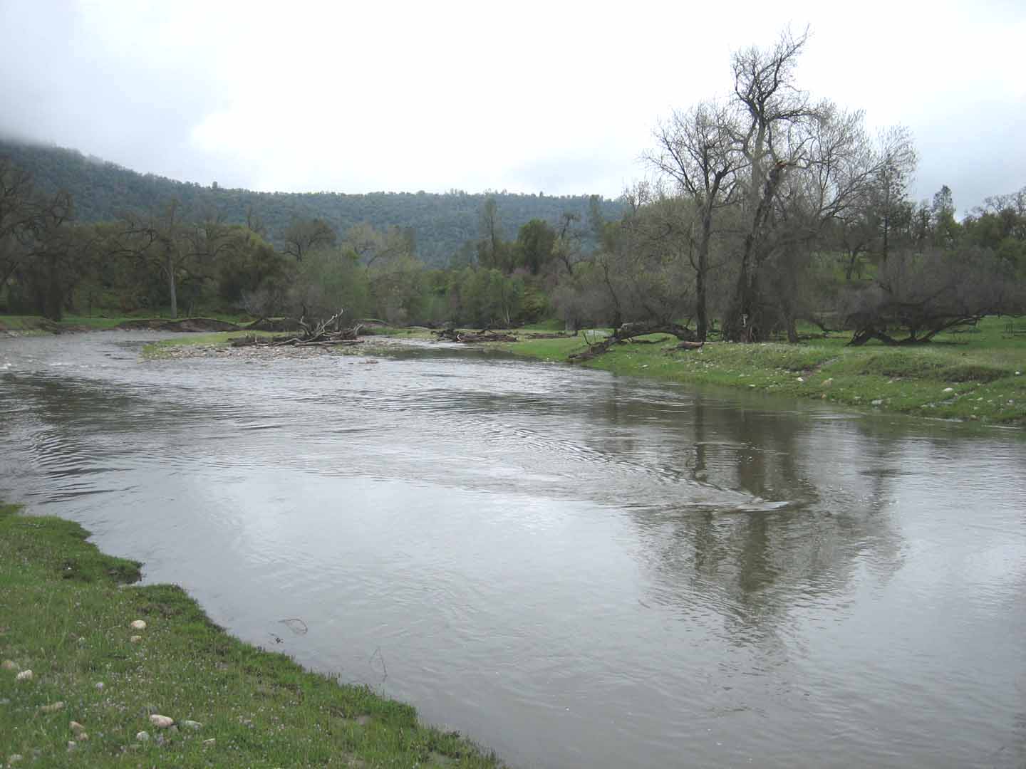
Chowchilla River
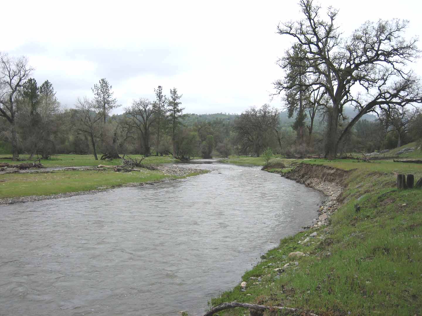
Chowchilla River
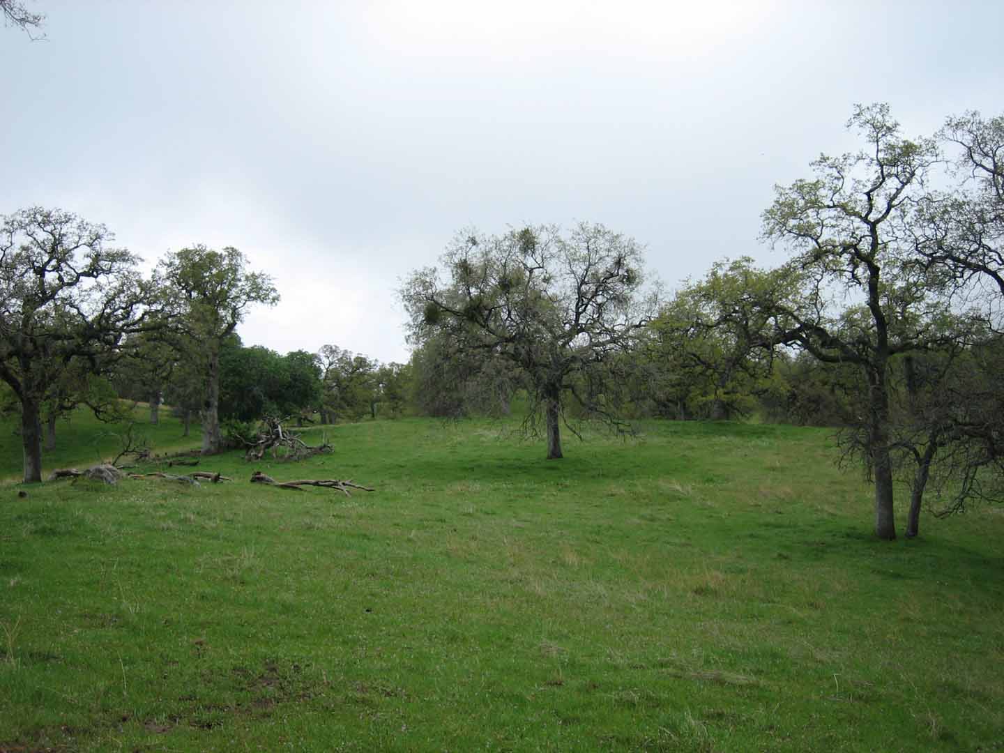
Upper Meadows
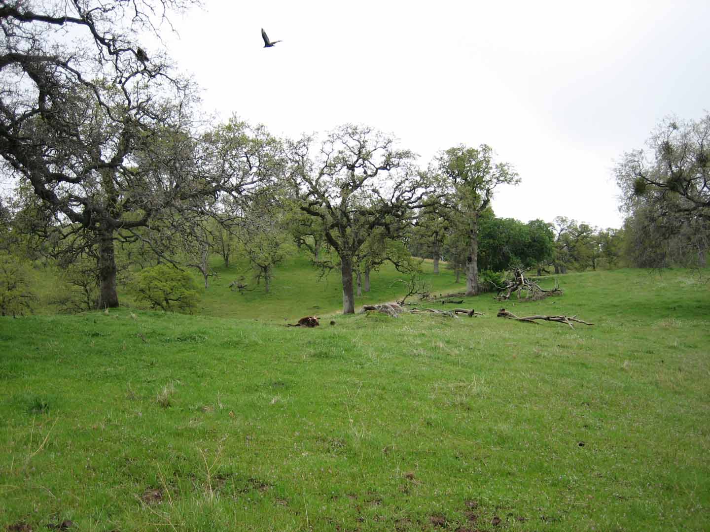
Upper Meadows
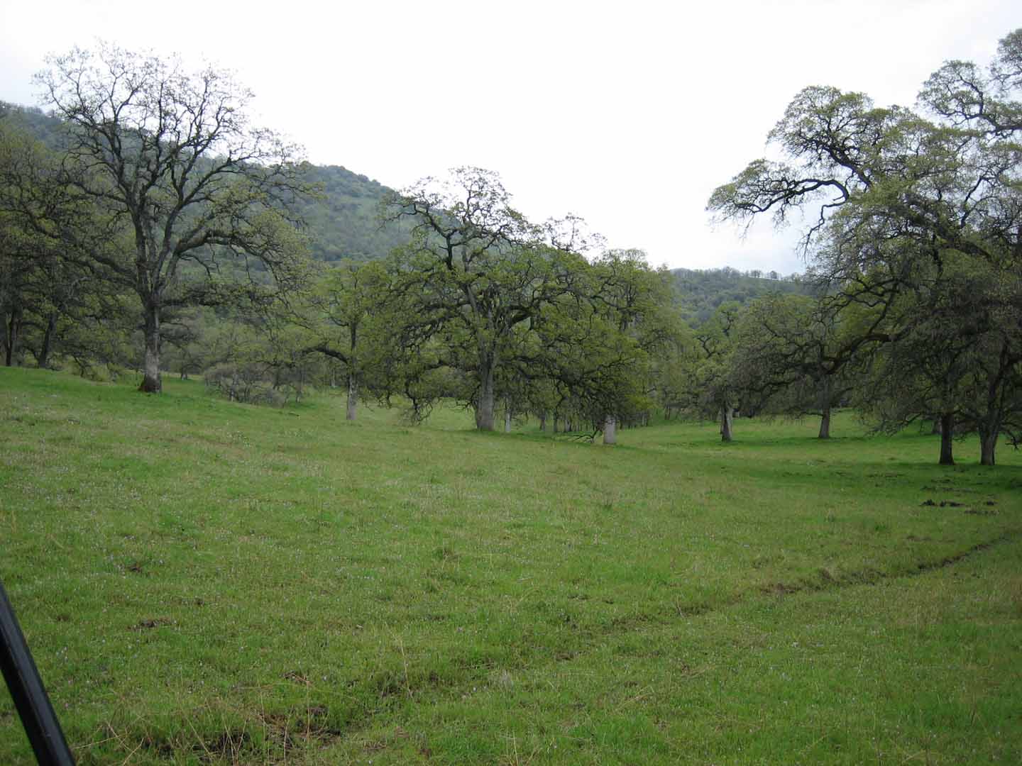
Upper Meadows
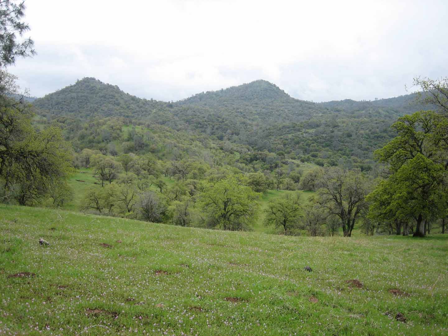
Upper Meadows with Views looking South
Mountain Top with Views of Lower Meadows and River
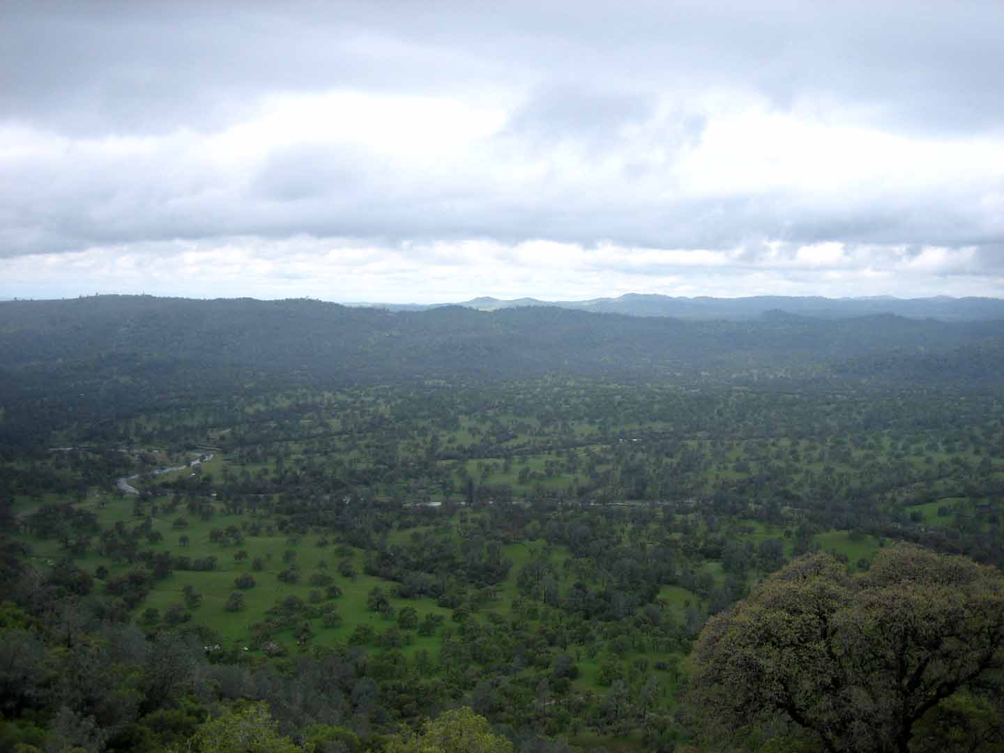
Views looking West for Mountain Top

Upper Creek
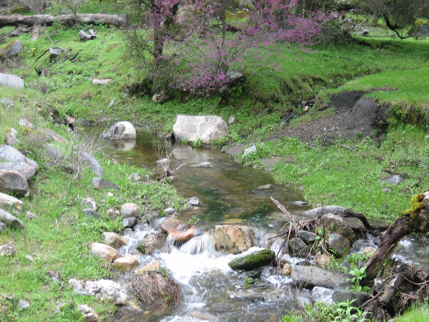
Lower Creek by Springs

Large Spring Area (picture taken in late October)
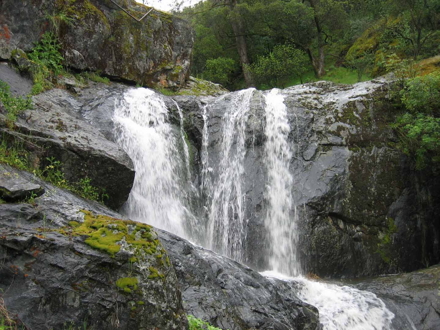
Waterfall just below the Spring
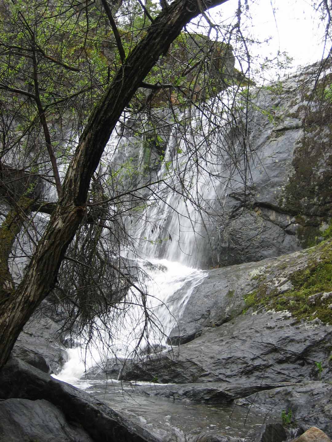
Waterfall just below the Spring

Grinding Rock near River. Ranch has many other Grinding Rock
locations

Old Homestead House on Lower Meadow Area
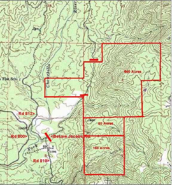
Topography Map
Price and Availability are subject to change without notice
All information provided is deemed reliable, however we cannot
guarantee
its accuracy and we assume no liability for errors or omissions.
Prospective purchasers should independently verify all items of
interest with their own sources and should consult with various
professional
and governmental agencies for additional information and conditions.
©Copyright2003 - RExInet - All Rights Reserved